xxxx -this is not shown

xxxx -this is not shown
Sixty days on the road.

Sunday, October 15, 2017

North into Winter


Warm days and nights of Oklahoma are gone now.  Fall colors are just beginning in Missouri, prophesying winter.


Morning sunbeams penetrate the forest, making bright the night foliage. But not for long.  These trees become transparent in winter, and I hope that holds off for just thirteen more days, until Chicago. 


Pine Forest

These pine trees must be the envy of the hardwoods.  They will stay green, with white fluff off and on, throughout winter.  The bird will not lose his summer cover.


Loose dogs can become a menace for cyclists.  Most of us who have ridden long distances in the country have stories.  Mine involves  a little white dog that I ran over a few years ago when it came out to bark.  Little dogs seldom bite, but they like prove they are big by sounding tough.  This little yapping dog ran right in front of me.  I lost control as my front tire bumped over its back with a crunch.  I went down with minor injuries.  The dog yelped and I never saw it again.

The dog in these picture just wanted to play.  He followed me, ran beside me and ahead of me for about two miles, and he never barked.   


Café food in Missouri small towns is about like it is in Pasadena except that portions are larger and prices lower.  In this café I’d say the portions are double, and the price  half.  This is fine for climbing the hundreds of hills in these Ozark Mountains, but not so fine otherwise.


Michael Angerman updates the map of my journey every day.  Find it at:  Google Map Link for my ride from Pasadena to Chicago When you first open the map, zoom out to see the overall picture, then zoom in to any section.    


Thursday, October 12, 2017

Missouri


A pedestrian crossing a Missouri road as fast as she can, like a cyclist running away from a loose, barking dog. 


Progress is slower in Missouri, lots of hills and few shoulders to ride them on.  


Sometimes the old road is much as it was in the 1930’s.  But then it hummed with traffic and they had to weave pas teach other on a road too narrow to pass without driving on the dirt shoulder.  It seems the same today for me on a bike.  I often have no place to pull off and let them by, so they weave around me, and most of them are safe and polite.. 


Road Angel
in the Missouri Hills
I learned more about heartland people than their politic when my bike broke down.  It required a repair I could not make.  So I put out my thumb, and a woman came by in a little car.  She was going to Springfield where a bike shop is, a distance of 25 miles.  But alas my bike would not fit in her car.  So she flagged down a truck and two good-ol-country-boys just hefted it on, and off we went to the bike shop.  To make a breakdown even better, the bike shop owner lent me a vacant apartment for the night and the woman who first stopped took me to a fine restaurant.  


The hippie flat I had the privilege of sleeping in.  


Sunday, October 8, 2017

Leaving Oklahoma

You remember how terrified I was last May, hunkered in a dark motel room, in a fort I had built with flashlight, bed, tables and chairs, as wind howled outside.  I knew that if the tornado hit, my fort could fall.  I rode the train home a few days later.  


 I returned to Oklahoma City a few days ago with new confidence.  These past five days traversing the rest of this state have spawned a rethink of what seemed like a treacherous state for pedaling on a bicycle.  There are no tornadoes this time of year, and the roads in the eastern part are mostly wider, with paved shoulders.  And people are friendly.  Maybe these factors come with the end of tornado season. 


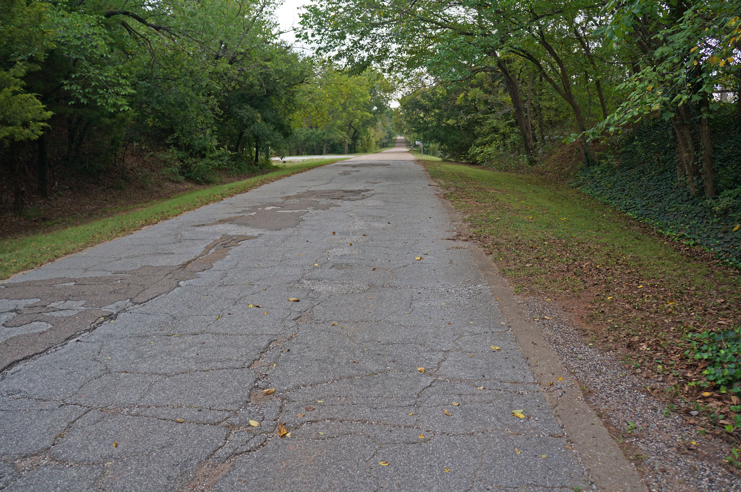
In engineering The Mother Road, it made sense to use existing roads where possible.  Here we see remnants of a preexisting paved road from Afton to Miami that was only nine feet wide.  If a car came from the other direction, you had to go off on the shoulder.  Now called “Ribbon Road” or “Sidewalk Highway,” it rested on concrete base and curbs, with surface of asphalt mixed with crushed rock.  These were the first sections of pavement on Route 66 when it opened in 1926.  


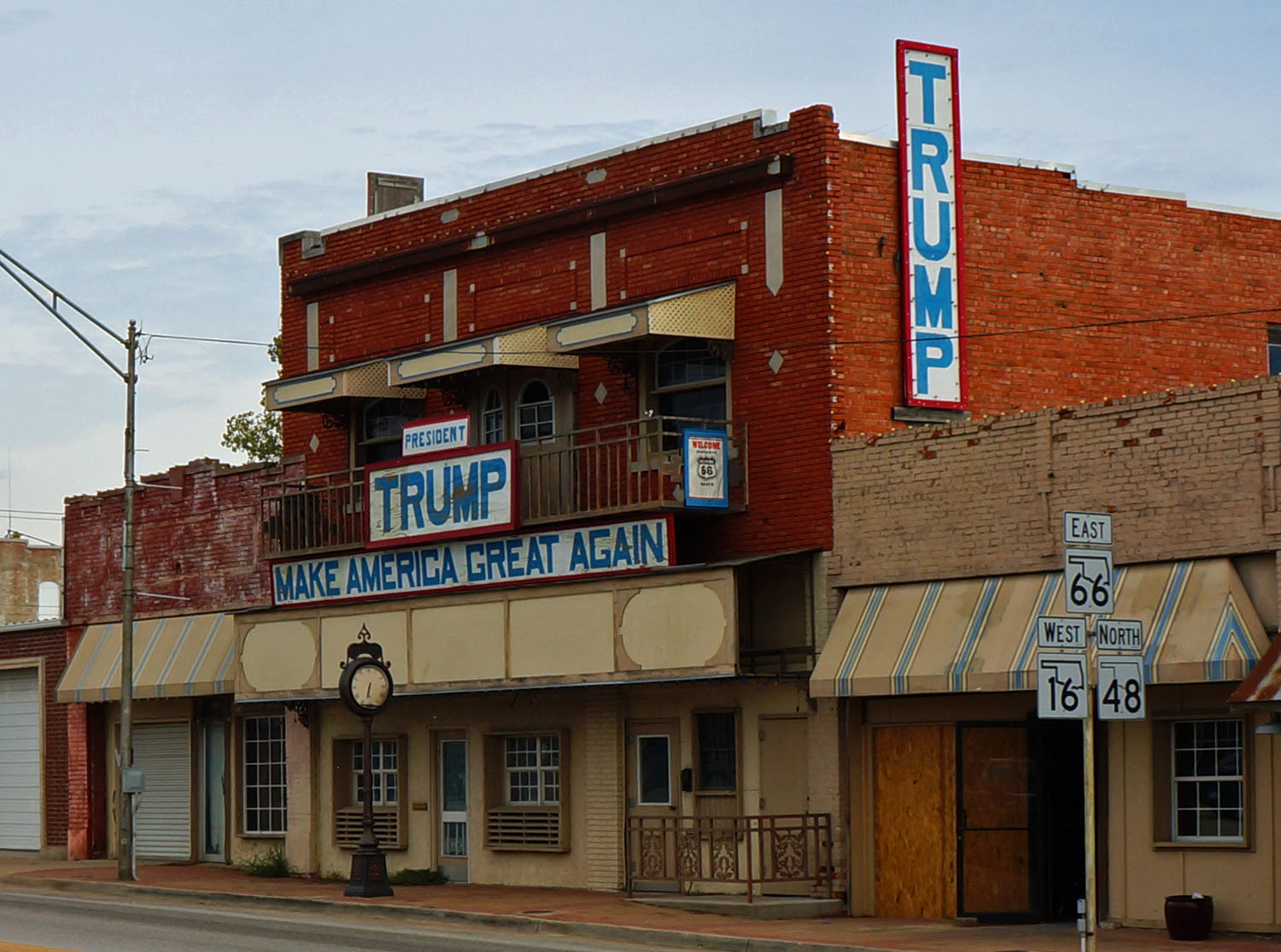
Remnants of the original Mother road decay into the earth beside remnants of the past election.  We Californians sometimes have difficulty understanding heartland politics.  These pictures may help or hinder. 


I parked beside a soybean field, better known in Pasadena as edamame.


A peaceful road for riding across Oklahoma. 


Michael Angerman is continuing a map of my journey as he did on the first section when I arrived in Oklahoma City on May 18 this year. Find it at:  Google Map Link for my ride from Pasadena to Chicago When you first open the map, zoom out to see the overall picture, then zoom in to any section.

Wednesday, October 4, 2017

Leaving Oklahoma City

x


Oklahoma City is  pretty view from a distance, but up close it’s fishing from a bridge, run-down motels, and gas for $1.99.  They don’t try to keep smog out of the air because the incessant wind blows it all to California. 


You can buy this large 3 bedroom house on  55 acres near Oklahoma City for  $465,000 or you can buy a nice condominium in Pasadena for the same price, and pay $3.00 for gas. 


I said good bye to the Joad family in John Steinbeck’s “Grapes of Wrath”  as I left the city. They joined Route 66 here on 23rd Street   

 “The family on top of the truck, stared about at the stores, at the big houses, at the office buildings.  And then the buildings grew smaller and the stores smaller. . . Its bigness and its strangeness frightened them with the fine-clothed people they saw.  They did not speak of it to each other—later they would, but not now.  They saw the oil derricks in town, on the edge of town; oil derricks black, and the smell of oil and gas in the air.  But they didn’t exclaim.  It was so big and so strange it frightened them.”  


It was good to leave the big city and get into the green humid countryside of middle Oklahoma.  An old gas station with its crafted local stones must have been a welcome stop in the 1930’s,  and an ultra-modern gas station might someday be looked on with antique eyes in another century.  


Old Route 66 much as it was in the 1940’s.  Once it carried thousands of cross-country travelers,  now used by a few locals to get to their farms.


In 1889 this land was opened for homesteading, and a great land rush followed.  This round barn near the boom town of  Arcadia was built in1898, before Oklahoma was a state. The farmer who  built it knew about tornadoes and figured a round barn could withstand them.  Apparently he was right. Most of the original barns aren’t here anymore.


Boomerang Diner
Chandler
I rode into Chandler yesterday afternoon, tired after a roller-coaster ride in the green hills of Oklahoma. In the little Boomerang Diner, old-timers sat at a long table talking polite in their drawls, like clones of an ancient homesteader who probably didn’t build a round barn.


It was good to check into the Lincoln Motel.  The forecast was for thunderstorms today, so I decided not to dare the devil, which might carry those little twirly things inside its thunder.  I’m  sitting here at noon in this comfortable room, writing to you and watching the rain.

Michael Angerman is continuing a map of my journey as he did on the first section when I arrived in Oklahoma on May 18 this year. Find it at:  Google Map Link for my ride from Pasadena to Chicago When you first open the map, zoom out to see the overall picture, then zoom in to any section


Wednesday, September 27, 2017

Return to Oklahoma City

Nostalgia, anticipation, and a sense of danger have won over a peaceful life at home in Pasadena.  Off again this Friday to complete a trek begun last April 5. 

On the first attempt, with intent on reaching Chicago by June 15, I and the bicycle got as far as Oklahoma City before being driven back by tornadoes.  It was weather that drove farmers from the Dust Bowl via Route 66 to California in the 1930’s, and weather of a different kind that drove me home.   


The difference this time is that tornadoes are very unlikely during October.  I should make it to Chicago and arrive home by Halloween.  

Please join me in some way, commenting here on the blog or by email.  I welcome your thoughts and poems.  But, of course, you can ask to be removed from this list, if it’s all too much. (Click on any picture to make it larger.)

Route 66, the “Mother Road” in John Steinbeck’s “Grapes of Wrath” brought Dust Bowl refugees to California in the thirties. I retraced those refugees upstream to Oklahoma City, but I won’t follow them any further, because they joined Route 66 in Oklahoma City or points west.  Instead, I’ll climb little hills of the Ozark Mountains in Missouri and ride through some of the Rust Belt approaching Chicago.  From there, Amtrak will again whisk me home.

Saturday, May 20, 2017

Going Home

.
Map of the places I have slept, prepared by Michael Angerman.  Click on the link below to open an interactive version of the above map, where you can zoom and pan.


I pushed eastward through Oklahoma, through strong winds, hail and tornado warnings—Elk City, Weatherford, Yukon, Oklahoma City.  And even here in the big city the TV screams “Tornado Warning—Take Shelter!” 

Elk city during the tornado of  5/16/17,
the night after I slept here.  (not my photo)
Elk city during the tornado of  5/16/17,
the night after I slept here.  (not my photo)


Elk City tornado pictures.


Steady, strong wind all day.  This video shows wind in a wheat field:


Yesterday, in the midst of thunder and lightning, I decided it’s been enough.  Sure, weather will improve, but the roads of Oklahoma and the way people drive will not.  Strong wind makes the bike swerve, and on a shoulderless road, with narrow driving lanes, a swerve can be deadly.

It's a sad decision I have made, between failure and wisdom.  In the end it depends on emotion.  How will giving up affect the future of what I do?  Will it set a pattern against what I am--one who pushes on?  In Chinese philosophy, yin and yang describe how seemingly opposite or contrary forces may actually be complementary, interconnected.

It was in this quandary that I placed a call to Amtrak and booked a train home.  I will leave Oklahoma City on Monday.


Tuesday, May 16, 2017

East to Oklahoma

.


After Amarillo, I had mostly smooth sailing, mostly along frontage roads of I-40, which was once The Mother Road—Route 66.  Almost no cars travel the old way, now that I-40 gets them there faster.  But for me on a bike, the frontage road and the old road are mostly smooth and without the irritation of cars.  


Shamrock is the last town in Texas and a day off for Mother’s Day.  Even though I’m not a mother, they assumed I am at McDonalds, and gave me this rose, as to all the women coming there for morning coffee or to chat.  Strange that McDonalds has replaced the old local cafes that once served locals and travelers on Route 66, but it has.  


A single blade for a wind generator travels through Shamrock, and the locals pay it no mind.  Thousands have come before it.


And there’s a quaint, old part of town—but not really, it’s a huge mural trying to attract visitors to a town that has no more reason to exist.  Most shops have already closed and others look like boards will go on the windows next week. 


Texas ends and Oklahoma begins with not even a sign to say so.


The first town in Oklahoma is Texola with the Tumbleweed Café.  Margaret, the owner, talks about her travels to the only customer in the café, and she talks about the weather. Baseball-size hail, tornados, severe rain, and flooding roll off her tongue like poems at an open reading.    She seem proud to live in a place where weather can kill you on half-an hour’s-notice and where many a house and car has succumbed to the ravages of severe weather.


Oklahoma is wetter and greener than Texas; and it has more creatures.


Bikers from Spain


Swallow City under a bridge 


As I write this, the weather report says “Thunderstorms possible at 6:30pm.”  It’s now 3pm and they have moved that warning from 3:00 to 6:30 and changed it from “Severe thunderstorms” to “Thunderstorms.”  Oklahomans revel in their weather forecasts, like watching a action-filled movie.  They talk about cousin Sam caught out in a hail storm, and “By God I’d better get the car inside; don’t want any hail on my car.”


I stepped outside the motel room in Weatherford just now to take a picture looking southeast, the direction of incoming clouds.  I stopped here early today because all this weather talk had me worried.  It doesn’t look severe, but it’s hard to stand in the 30mph wind. 


After Texola, I spent last night in Elk City, a town that seems thriving.  I asked at the café this morning in Clinton, the next town along this march through Oklahoma, why Elk City looks thriving, while Clinton is mostly closed and abandoned.  “Oil’s gone,” the waitress said.  “It just stopped all at once—drilling, trucking everything.”  “What about wind?” I asked.  “Oh we’ve got plenty of wind.  Texas has wind farms, Weatherford to the east has wind farms, but the politics here prevents it.” 

And after leaving Clinton and approaching Weatherford, I saw the difference.  Both towns lost their oil industry, but Weatherford is installing wind generators, just like Texas has, and the town is booming.


The map below shows the places I have slept, prepared by Michael Angerman.  Click on the link below to open an interactive version of the above map, where you can zoom and pan.