Leaving Kingman an hour before first light, the road was smooth
and wind non-existent. I cruised easily
into the dawning sky, and then the sunrise.
And there along the side of a desert road, I attended Easter Sunrise, and
experienced an awakening out there among the sparse vegetation, in a meeting
of one; make that two.


In the first glimpse of sunlight, flowers responded with hope—for
pollination, for future children. Come,
they seem to call to the insects, let us together give something to the next
generation. And in this hope, they softly
bloom. It seems to me that our children
would get this Easter Sunrise hope and understand it, tossing aside bunnies
that lay eggs, if we only allow them.


Regardless of your religion or lack on one, the sun still rose
this morning, and its meaning seemed to transcend scientific
explanations. It and all it nourishes
seem to say that beauty and meaning abide in what we see.


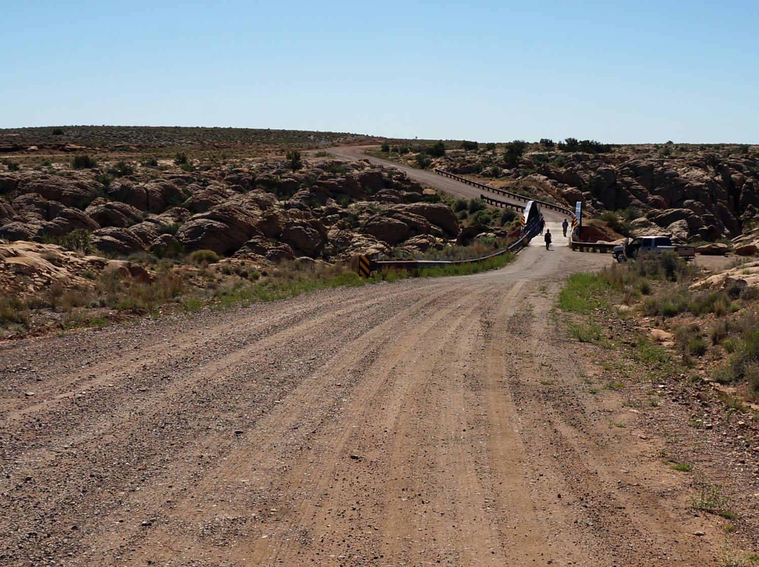
Riding on old Route66, I come Hackberry, one of the towns
bypassed by I-40 and left to die. The
only remaining business is the Hackberry General Store, begun in the thirties,
thrived in the fifties, and hanging on with its décor of old-time funkiness for
the few passing tourists.


The store is loaded with Hy66 memorabilia and souvenirs. I considered the variety of tee shirts, but
until I get close to Chicago, such baggage remains in the store.
 |
| Valentine |

Valentine passed with nothing left to serve the Dust Bowl
jalopies or the fifties sleek sedans.
And the trains still whizz past me, pedaling old 66, the Mother Road.


Next comes Truxton, where the two motels are dead, and only a
gas station remains.


I Could have rested my bones at the plush Hualapai Indian
Reservation Hotel in Peach Springs, or the hotel at Grand Canyon Caverns, but
they have nothing to do with the old Mother Road. One of the motels in Truxton would have been
fine, but I pushed on into the sunny afternoon with wind mostly on my back.


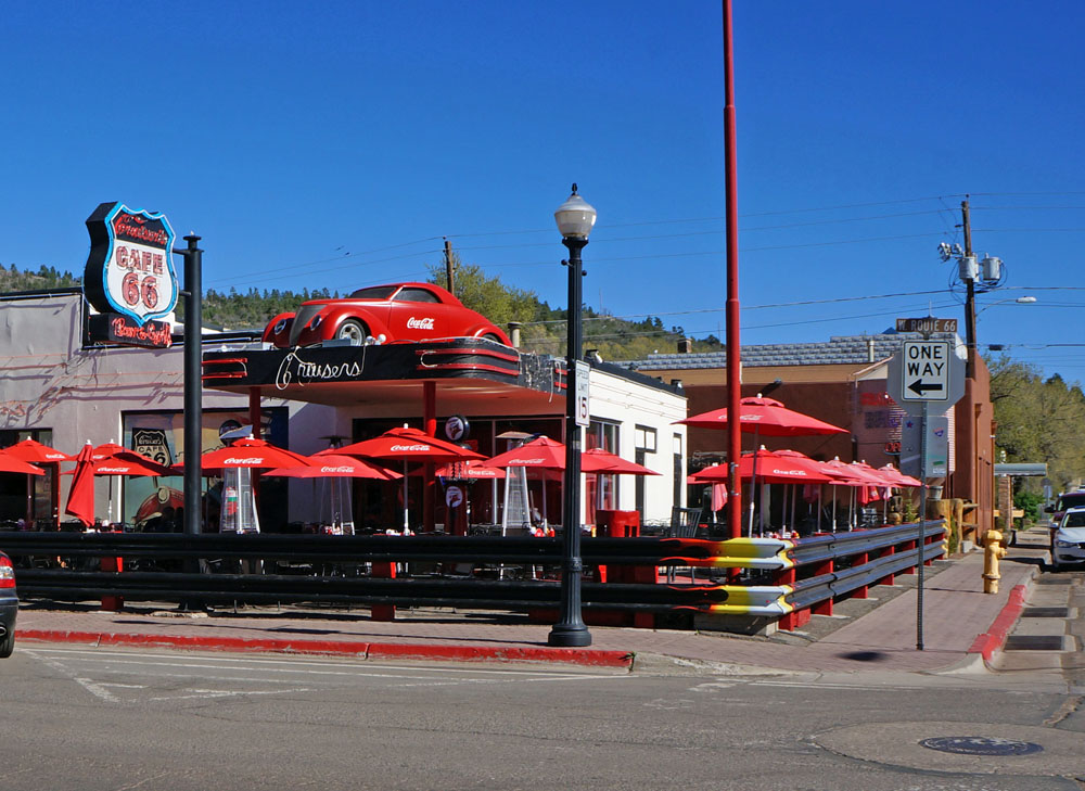
I came finally, after 88 miles for the day, to Seligman, a
town that has fared better than most against the monster— I-40. It tries to promote spirit of times
past.
I rode into town on a tired horse. Hitched him up outside. Went in for a brew. Like an old rusty nail, I’m used to it now—the
wind, the hills, and the cars, ten hours of pushing pedals. Not much affects a bike-mule ten days on the
road out of Pasadena.
A man walked in with clattering feet, sounding like bicycle
clips on his soles. He’d seen my horse
out front, and now a bedraggled woman with tangled, matted hair at the counter
with biking shorts and a bright yellow shirt.
“Where ya ridin’ to” he said from behind. Then came around to face me. A face dark with sun except for pale stripes down his
cheeks where helmet straps had blocked the sun. His hands just as dark, but the wrists were
white where shirtsleeves had covered them.
I knew right away he was the real deal.
“Chicago” I said with a sheepish grin, and wondered if he
believed. He’d rode to Seligman from
Kingman today, as I had. But he left at
nine, while I’d been five hours on the road.
I started in darkness to make this trek before dark, and I’d done it
with an hour to spare. He came in the café
just 15 minutes behind me.
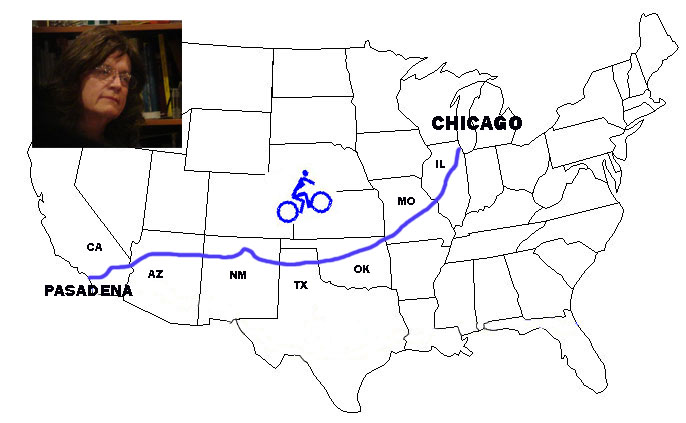
You can see my progress on an interactive map, prepared by
Michael Angerman, at:
Zoom and scroll to see where I’ve been.


 As I rode the main street of Grants, which is Route 66, I saw
almost no mention of the old road’s history or charm, no buildings carry the
torch. Unlike other Route 66 towns, much
of Grants is boarded up, and its only thriving section is at an I-40 exit. There is, however a café with real New
Mexican enchiladas as I remember them for their hot green chili, that will burn
the insides of most Californians.
As I rode the main street of Grants, which is Route 66, I saw
almost no mention of the old road’s history or charm, no buildings carry the
torch. Unlike other Route 66 towns, much
of Grants is boarded up, and its only thriving section is at an I-40 exit. There is, however a café with real New
Mexican enchiladas as I remember them for their hot green chili, that will burn
the insides of most Californians.